The following is a draft translation of Chapter 18 “Seongnam: Gwangju Daedanji, Bundang, and Pangyo New Towns” from the book Kaldŭng tosi 갈등 도시 [Conflict city] (2019), by Kim Shiduck (김시덕 Kim Sidŏk).

Chapter 18. Seongnam: Gwangju Daedanji, Bundang, and Pangyo New Towns
As is well known, Seongnam City is broadly divided into three parts {namely: the original downtown of Jungwon-gu, Bundang-gu, and Pangyo}. From the 1960s, the urban poor of Seoul were forcibly relocated to Gwangju Daedanji housing site, which has become Sujeong-gu and Jungwon-gu districts of northeastern Seongnam. Between 1962-1985 this area hosted the military prison camp 육군교도소 beneath Namhan Mountain Fortress and was thus very much a frontier region of greater Seoul. Those who were in the army at this time would be familiar with the expression “going to Namhan Mountain Fortress.” Another name for the prison was Hwimangdae (희망대 “hope platform”) and because there were few other distinctive features, Hwimangdae became a general name for the whole area. Residents of houses in the area of Hwimang Park 희망 대공원, that was first constructed around that time, have recently nearly all been relocated due to current redevelopment.
In 1963 the administrative region of Seoul City was greatly expanded. As the incoming population from the provinces continued to increase, the government and Seoul City implemented policies to demolish the city slums {빈민촌 lit. “village of poor citizens”} and forcibly relocate their residents to the outskirts of Seoul and to the surrounding Gyeonggi (Kyŏnggi) Province. Relocation began in 1969 and by 1971 the population of this region had reached around 150-170 thousand. Seongnam administrative office 출장소 was established by the Gyeonggi authorities in the vicinity of the current Seongnam branch of E-Mart. This continued to function as the Seongnam city hall until 2009. Still today, the bus station named “(Old) City Hall, Sinheung 1 dong, Administrative Welfare Center” (구)시청. 신흥 1동 행정복지 센터, testifies to the Gwangju Daedanji period of the area’s local history.
From satellite images of Taepyeong-dong district north of E-Mart, one can readily see the area has been divided up into closely clustered square plots. What can’t be seen from the satellite images but becomes readily apparent upon visiting is that this area is a relatively large hill. They say that the authorities drew the plots as lines in the mud on the denuded hillside, then loaded Seoul urban poor onto trucks and threw them off at this place. Given that the topography has not changed since then, we can still appreciate that if one looks down the valley from the top of the hill the height perspective becomes muddled. Not long ago, this phenomenon trended online as “Seongnam Inception.” It may sound nice to reference Inception but in reality the valley is so narrow that local buses cannot enter, and the hill is high, so for several decades the residents have had to endure great inconvenience.
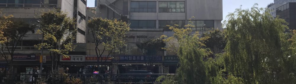
If one walks the narrow streets that were the original downtown area 원도심 (wŏndosim) of Seongnam, one can see such shop signs as “cooperative market” 공판장 that one usually sees in old (rural) villages, but at the same time there are also advertisement signs referencing place names in Gangnam {the southern central district of Seoul City} such as Yeongdong 영동 or Cheongdam 청담. Travelling around South Korea today, one often sees redevelopment and reconstruction projects that are modelled on Seoul’s Gangnam. Through such street signs one can confirm that in the original downtown area of Seongnam, too, conflict occurs between residents who try to live in the area as it original was, and those who, through such names as ‘redevelopment,’ ‘new town,’ or ‘urban revitilization,’ are ultimately seeking to change it. The area of Chungdong 중동, for example, that used to function as a redlight district on the outskirts of greater Seoul, is now being redeveloped into high-rise apartment complexes. In this manner, the original downtown of Seongnam that had once been called Gwangju Daedanji 광주 대단지 is erasing its past and assuming a new shape. There is one small neighbourhood of urban poor located to the southwest of Bokjeong Station 복정역, on the border between Seoul and Seongnam that remains as a last ‘urban fossil’ from the Gwangju Daedanji period.
It is common for urban poor to work as day laborers in the center of the city, so that is where they need to live. There is the case when, after the fire at Guk’il gosiwon 고시원 residence in Jongno district {central Seoul} on 9 November, 2018, Seoul City government found temporary accommodation for the survivors on the outskirts of the city, but those survivors ignored the offer. The case of Gwangju Daedanji was similar. Those who first relocated to Gwangju Daedanji returned to Seoul after just a few months. The land became the object of complicated real estate deals. While the government sought to impose controls, during July-August of 1971 a citizen uprising occurred {Gwangju Daedanji}, an event rare in Korea’s contemporary history. The military governments of Park Chung Hee and Chun Doo Hwan both responded fiercely to anti-government struggles of workers {i.e. organized labour} and students, but they responded more moderately both in the case of the Gwangju Daedanji incident, and that of the Mok-dong struggle 목동 투쟁 {that occurred in 1985}. In the case of Gwangju Daedanji, aside from the sentencing of twenty-two participants, the government and Seoul City accepted the residents’ demands {for promised infrastructure and support}, and thus the city of Seongnam came to be born.
In Seongnam today, opinions collide between those who want to accept Gwangju Daedanji as the origin 원형 {lit. “original shape”} of Seongnam and those who oppose this. In 2017 when I was writing my previous book, Seoul Proclamation (서울 선언 Sŏl sŏn’ŏn) and posted to a social network service that I would include mention of Seongnam, I was contacted by several persistent persons who expressed that they would be watching in what manner I would treat the relationship between Gwangju Daedanji and Seongnam. I guess that these people were not residents of the original downtown whose relocation there as urban poor marked the beginning of Seongnam, but rather those residing in Bundang-gu district who had moved south into Seongnam through the expansion of Seoul’s Gangnam. When exploring on the ground in September 2018 I had the chance to confirm this conflict between Seongnam’s original downtown district, and Bundang new town. I photographed graffiti from the mens’ toilet at Moran subway station (Bundang Line) located between the original downtown and Bundang (see photo on p446 “Seongnam f***ers, do not cross into Bundang…”).
In any city there are conflicts between areas, but the conflict between the original downtown of Seongnam and Bundang is known to be particularly extreme. The conflict has even extended to a movement for an independent Bundang city. In an effort to resolve the conflict it seems as though Seongnam city hall has been positioned centrally between the original downtown and Bundang. However, if one actually walks around the area, in between the original downtown and the city hall, they have established a natural park area, whereas one can walk directly between the city hall and Bundang so in reality the city hall has been relocated from the original downtown to Bundang. Currently in provincial cities around Korea, as the main administrative offices 관청 are relocated from the old centres to the new towns, the old centres are being left hollowed out, with only hollow calls for their regeneration. Unfortunately, Seongnam is no exception.
Constructed 형성 in 1989, Bundang New Town separated from the old Seongnam city centre of Jungwon-gu to become Bundang-gu in 1991. Ironically {흥미론운 것은}, the residents of Bundang-gu are now opposing the establishment of an independent Pangyo-gu that would involve the separation of Pangyo New Town from Bundang. There are various reasons that Bundang residents oppose the establishment of Pangyo-gu, but we may speculate that because the Pangyo is best known for the Naver offices 네이버 사옥, were Pangyo New Town to gain independence, Bundang’s own fame would be considerably weakened.
The two new towns of Bundang and Pangyo are typically characterized as extensions of Gangnam, and regularly referred to as “Gangnang 5th district” 강남 5구 or “secondary Gangnam” 준강남. However, the aspect of this conflict on which I wish to focus are the voices of residents from the period when the area was comprised of farming villages and simply a part of Gyeonggi Province 농촌 경기도 시절. Such voices reveal their existence beneath the new towns. The conflicts between the original downtown and Bundang, and between Bundang and Pangyo are both ultimately conflicts related to class identity occurring between different migrant groups from Seoul. However, similar to other surrounding areas of Seoul, present-day Seongnam was originally an agricultural region 농업지역 of Gyeonggi Province. Those people who have moved to the new towns ignore this fact, but there were people living in this area before the new towns were built, and during the period of construction, considerable conflict occurred between those original inhabitants, and the development companies and local authorities 행정당국. After the construction of the new towns, a minority of those inhabitants such as the landowners re-settled in the area, but the remaining majority were pushed out.
The first new towns began to be constructed around Gwacheon, Seoul and Gyeonggi in the 1980s. Within the new town communities there is now a second generation that thinks of the new towns as their own “native homeland,” kohyang 고향. Among them, there is now a movement to document and preserve the (first generation) apartment complexes such as the Chu-Gong apartments 주공아파트 {that were built by Taehan Housing Construction Company 대한주택공사}.[1] Although not a first generation new town, such affection for new towns as this is exemplified in the following passage from a record text discussing Chu-Gong apartments in Gangnam, Seoul. “Why are we still only able to think about destroying (밀어 버리다) all things? Why do we so readily accept the loss of important things?” {Yi In-gyu. 2016. Ap’at’ŭ sup 아파트 숲 [Apartment Forest]. Maŭl e sum’ŏ 마을에숨어}. It is obvious, however, that even before the construction of the new town there were farm villages 농촌that to somebody else were [equally] beautiful and important. It is not only Chu-Gong apartments that have been someone’s valued kohyang, and in greater Seoul it is not only apartments that should be the object of preservation.
When conflict arises among residents who have either moved from central Seoul to the outskirts, or from Seoul City to surrounding towns, the residents of the Gyeonggi period farm villages either quietly hide themselves or 가만히 reveal their presence. Thus, when looking at the new towns of Gyeonggi Province that are on the outskirts of greater Seoul, it is key to examine what relations are formed and what conflicts arise between the following three groups: the residents of the Gyeonggi period farm villages, the first generation of migrants who moved from Seoul, and the second generation who were born in the new towns.
I have identified two sites of heritage in Seongnam City that pertain to the Gyeonggi period farm villages. In one corner of Songhyeon Park 송현공원 {Google Maps link}, located behind a high-rise apartment complex in Pangyo on the west side of the Bundang-Suseo Expressway, there is a stele erected in 1990 (Tan’gi 4323) named “Stele Cherishing Tonggan Village” 동간 마을 모향비 (慕鄕碑 lit. “Kohyang-cherishing stele”). Donggan is a village that was located in this area prior to the development of the new town. The stele is earnestly inscribed with the thoughts of the original residents, who at the time of departure yearned for a kohyang that was about to disappear, presumably having received appropriated compensation for the land. However, the Tonggan Village Stele is not marked on the park information board for Songhyeon Park. The obvious fact that people used to live here is ignored and forgotten. This is in stark contrast to the yangban {former class of scholar-officials} grave(s) and house(s) from the Gyeonggi period of farm villages that proudly occupy the Bundang Central Park. Reading the text of the Donggan Village Stele, one realizes that the plight of residents who had to leave their kohyang in accordance with national policy, was no different to the plight of those who had once resided beside the Han River {central Seoul} but were forcibly moved away {lit. “move inland”} due to redevelopment of the river area. In both cases they were “people who had lost their kohyang” 제자리 실향민. For this reason the first passage of the Donggan Village Stele mentions those who had lost their kohyang 실향민 through Korea’s division and the Korean War. It pains me that the existence of this village and stele is ignored by the residents of Seongnam New Town and so, although it is quite long, I reproduce the full text below. There is also a concern that the stele will be removed by someone with no interest in the period when Seongnam was a rural area of villages. There are many cases throughout the country where stelae commemorating former villages have been rudely locked away in storehouses.

Feelings (chŏng 정) gush forth at the new town.
The 38th Parallel (at which we feel) bitter resentment, and compatriots who left their local homelands (kohyang)!
Painful fate! With sorrow (han 한) drenched in blood,
The pain in our hearts is similar to feelings (chŏng) for our compatriots.
There is also hope in the fresh name of a “new town.”
Even though we try to bear the pain of leaving our kohyang,
There are circumstances of worry for the feeling of loss at going far away.
The mountains and streams of our kohyang where our ancestors’ grace and achievements 은공 have accumulated,
Human feelings (chŏng) have accumulated through those many years!
One can encounter the feelings (chŏng) of neighbours that cannot be forgotten.
Lament the mountains, rivers, grass and trees of the village we love!
However, we must bear {our pain}, and must find a new way.
Prepare a new home at a new place not far away.
Gazing at the site of our kohyang, still deeper feelings will arise.
With thoughts of divided families, we will cultivate love for the country
Without forgetting the dream of our kohyang that is etched in our bones
Let us make flowers bloom and beautifully establish them as a tower of flowers that will be the new town!
Let us make these rivers and mountains of our ancestral land 조국 into our kohyang all together!
Let us continue the accumulated achievements of those sacred and wise patriots!

Tan’gi 4323 August, Kim Ki-yong of Sasong-dong, Seongnam City

Concerning the position and name of the village
The former address was: 1 t’ong 2 pan, Sasong-dong, Sucheong-gu, Seongnam City. It was on the east side of the four villages comprising 1 t’ong local district, and was on the south side of the nearby mountain valley close to Sut-nae (“charcoal stream”) 숯내 炭川. Today it is in the vicinity of Seon’gyeong Apartments, building 113, Hatap-dong, Bundang-gu. The two mountain peaks east of the village strangely form an entrance to the village, that from the village was called tonggu’an “east entrance.” This gradually change to tonggan (Donggan) and became the name of the village.

Village history
In the mountains to the south there is an area of flat land of several hundred p’yŏng where there is the remains of a tiled house and path that is called “the original site” (said to have been the site of an inn for long-distance travellers) that dates to before the settling of the village. It is said that at the bottom of the mountain to the north there lived the Yi clan {family/descent group} 李氏. On the neighboring mountain there are two sites with grave stones but the dates are unknown. More certain is that around 300 hundred years ago, a person of the Ŭiryŏng (Uiryeong) Nam clan 南氏, who had moved here from Chingni, Kwangju-myŏn (Jingni Gwangju-myeon) 광주면 직리 and held the office of tongch’u 同樞, was buried by his children on the mountain behind the village. They also built a tiled house. Their arrival marks the beginning of the village. Their descendants have since moved to other areas. About 80 years ago, at the time that Chairman Kim Ku {independence activist, 1876-1949} escaped from Incheon Prison, several friends and brothers from {a branch of} the Kyŏngju (Gyeongju) Kim clan that had been living in Osan 오산 and who had been involved in an incident in which they killed Japanese soldiers, moved here in order to avoid the Japanese police. The number of houses increased and the village gained greater recognition. Thereafter the following families arrived and lived here affectionately {lit. “with deep chŏng”} each for several years. Before liberation, members of the Raju Chŏng (Raju Jeong) clan 라주 丁氏 came from Piasu 비아수 and lived here for around 30 years, while the Chinju Yi (Jinju Yi) 진주李氏 of Songhyeon-dong came around liberation for 20 years. Among the many refugees of the Korean War, the Ch’ŏlwŏn (Cheolwon) Chŏn (Jeon) 全氏 and Sim 沈氏  clans, and Chŏn (Jeon) of Hamgyŏng Province came and lived here for around 20 years. After the war, the Ch’ilwŏn Yun 尹氏 came from Nam’yang and lived here around 20 years. At the time of development {of Seongnam City} the Kyŏngju Kim of Yesan, South Ch’ungch’ŏng (Chungcheong) Province came and lived together, also for 20 years. Several other families lived here affectionately 정붙여 for a few and moved on. At the time of development the original residents 원주민comprised twenty houses/families of the Nam and Kim clans, together with several houses of new arrivals.

Characteristics of the village
The height, size and direction of two mountains formed a subtly wondrous 묘하게entranceway to the village. One was the last peak in a line that rises to the east behind the village; this was called  Ponghwang-dae (“Phoenix Platform”), and was where one could view the moon. The other was the last peak of the mountains in front of the village, beyond the grove of tall pines and poplar trees. The two peaks created a special effect as if they were guarding the village. On the east side of Ponghwang-dae was a medicinal-water spring that could reduce allergic reactions to lacquer trees 옻나무. Outside of the east entrance of the village was the clear Sut-nae steam, on which a water wheel turned for many decades. The mountain in front of the village was shaped like a boat and thickly grown with old pines. There many flocks of white herons would seasonally gather and nest. Beside the large well in the centre of the village that suckled {the village} for generations was a hawthorn tree some 200 years old that would be the first to bloom each spring with yellow flowers. To the back of the village and on either side was a mountain ridge thickly covered in chestnut and other trees and plants that provided a natural barrier against the wind. This coziness, like a samt’aegi three-sided straw basket, together with there being richly fertile fields in front of the village led passersby to remark on the village’s subtle wondrousness 묘하다는 마을. At various times of war and trouble the village became a place of refuge. We now raise this stele in commemoration of this place of deep affection and the affectionate scenes 정경 that with development {of Pangyo New Town} have disappeared without a trace.

Erected in the autumn of 1993, Tan’gi year 4326 by the members of the Association Cherishing their Native Home of Donggan Village.
Today, in an effort to preserve the identity from the Gyeonggi period farm villages, those who had once farmed this land prior to the establishment of Pangyo New Town have created an exhibition of agricultural artifacts at the Naksaeng Nonghyeop (Nonghyup agricultural bank) building. Those migrants {from Seoul} view Pangyo only as an extension of Seoul and a new destination for middle-class migration. They want to imagine that local history of the area connects directly from the twenty-first century to the mid-Chosŏn dynasty, to a small government office of P’an’gyowŏn 板橋院, from which the area took its name but that disappeared at the time of the Japanese invasions {1592-1598}. However, the Naksaeng Nonghyeop exhibition of agricultural artifacts is quietly shouting at such migrants that, until just a few decades ago there was a village called Naksaeng that was inhabited by farmers, and those [former] village residents are still living in this area {such that they organized this exhibition}. Concerning Naksaeng Village, one can consult Hyangt’to munhwa ch’ongsŏng 8: Naksaeng maŭl chi 『향토문화총서 8: 낙생마을지』 [The complete collection of local culture, vol.8: Gazetteer of Naksaeng Village]. Additionally Seongnam Culture Centre 성남문화원 has documented 기억을 정히하다 rural Seongnam from the period that it was a part of Kwangju (Gwangju) County by publishing gazetteers for each of the villages that disappeared with the development of new towns. These include P’angyo, Taewang, Pokchŏng, T’aep’yŏng, Kŭmgwang, Tandae, Sadaewŏn and Tolma (Pangyo, Daewang, Bokjeong, Taepyeong, Geumhwang, Dandae, Sadaewon and Dolma). It is a wonderful project.
[1] Translator’s Note: The term chugong ap’at’ŭ 주공아파트 refers to government subsidized apartments built by Taehan Housing Construction Company 대한주택공사. Such apartments were built as part of government housing policy from the 1970s onwards, they were aimed at low to middle wage families. The first and still iconic Chu-Gong apartments were built at Banpo-dong, Seocho District of Gangnam, Seoul. Through to the mid-1980s the Chu-Gong apartments complexes were typically five-storey buildings. Today, most have been replaced or are in the process of redevelopment.
Translated from Kim, Sidŏk, Kaldŭng tosi 갈등 도시 [Conflict city] (Paju: Yŏllinch’aektŭl 열린책들, 2019), 441-453.
